
APRIL 2008
LINCOLN, NE
NEWS: Tornado Hits Southeast Nebraska early morning April 25, 2008.
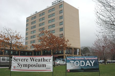
CPSWS 2008 and Weatherfest Photo Gallery is now Available
Also See Our April 2008 Photo Gallery AND And See Our Spring Colors 2008 Photo Gallery
Lincoln Live Weather Watching Web Cams
Lincoln, NE, Monthly Snowfall 2007-08
| 1.1 | T | |||||||
Year 2008 Precipitation
(in inches)
compared to normal: red above
normal, blue below
normal
| 3.80 | - | - | - | ||||||||||
PREC MAX MIN | ||||||||||||||
| 56 | 26 | 41 | -5 | 0.00 | 24 | 0 | ||||||||
| 45 | 30 | 38 | -9 | 0.32 | 27 | 0 | ||||||||
| 62 | 31 | 47 | 0 | 0.00 | 18 | 0 | ||||||||
| 68 | 41 | 55 | +8 | 0.00 | 10 | 0 | ||||||||
| 66 | 33 | 50 | +2 | 0.00 | 15 | 0 | ||||||||
| 51 | 31 | 41 | -7 | 0.18 | 24 | 0 | ||||||||
| 52 | 35 | 44 | -4 | T | 21 | 0 | ||||||||
| 59 | 29 | 42 | -7 | 0.15 | 23 | 0 | ||||||||
|
|
44 | 36 | 40 | -9 | 1.05 | 25 | 0 | |||||||
|
|
39 | 34 | 37 | -13 | T | 28 | 0 | |||||||
|
|
43 | 34 | 39 | -11 | T | 26 | 0 | |||||||
|
|
51 | 29 | 40 | -10 | 0.00 | 25 | 0 | |||||||
|
|
60 | 21 | 41 | -10 | 0.00 | 24 | 0 |  |
||||||
|
|
77 | 40 | 59 | +8 | 0.00 | 6 | 0 | |||||||
|
|
71 | 51 | 61 | +10 | 0.00 | 5 | 0 | |||||||
|
|
51 | 41 | 46 | -6 | 0.92 | 19 | 0 | |||||||
|
|
47 | 36 | 42 | -10 | 0.52 | 23 | 0 | |||||||
|
|
67 | 35 | 51 | -2 | 0.00 | 14 | 0 | |||||||
|
|
80 | 42 | 61 | +8 | 0.00 | 4 | 0 | |||||||
|
|
63 | 49 | 56 | +3 | 0.00 | 9 | 0 | |||||||
|
|
72 | 39 | 56 | +2 | 0.00 | 9 | 0 | |||||||
|
|
78 | 35 | 57 | +3 | 0.00 | 8 | 0 | |||||||
|
|
69 | 56 | 63 | +9 | 0.03 | 2 | 0 | |||||||
|
|
56 | 35 | 46 | -9 | 0.52 | 19 | 0 | |||||||
|
|
52 | 30 | 41 | -14 | 0.11 | 24 | 0 | |||||||
|
|
57 | 31 | 44 | -11 | 0.00 | 21 | 0 | |||||||
|
|
54 | 30 | 42 | -14 | 0.00 | 23 | 0 | |||||||
|
|
64 | 36 | 50 | -6 | 0.00 | 27 | 15 | 0 | ||||||
|
|
79 | 46 | 63 | +7 | 0.00 | 2 | 0 | |||||||
| 3.80 | ||||||||||||||
| 59.0 | 35.6 | 47.3 | ||||||||||||
|
DEPARTURE
|
-4.5 | -2.2 | -3.9 | +1.10 | +97 |
Warmest recorded APRIL temperature, 97 F, April 26, 1989; April 28, 1910. Coldest recorded APRIL temperature, 3 F, April 3, 1975. Most APRIL Snowfall: 11.1 inches, 1997. In the last 109 years, 1900-2008, April had measurable snowfall 52 times In the last 109 years, 1900-2008, April had NO measurable snowfall 57 times AVERAGE AND
TOTAL are APRIL 2008. |